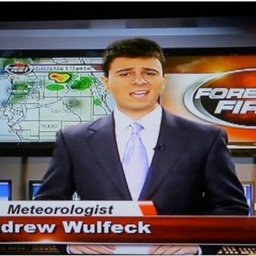
Andrew Wulfeck
Meteorologist at FOX Weather
Meteorologist at CBS4 News - WGFL
Meteorologist
Articles
-
3 weeks ago |
foxweather.com | Andrew Wulfeck
A record-breaking 37.5 million metric tons of seaweed was detected during May, with biologists warning that some Caribbean resorts maybe blanketed by the naturally occurring phenomenon during the coming weeks.
-
3 weeks ago |
fox9.com | Andrew Wulfeck
The largest fires are burning in Manitoba, but due to prevailing wind patterns, plumes of smoke have drifted southward, reaching as far as the Gulf Coast. Satellites captured stunning imagery as smoke appeared to embed itself around a storm system moving through the East. According to air quality readings across the Lower 48, the smoke was most hazardous across the Plains and the Upper Midwest, with moderate levels reaching as far south as Georgia and the Carolinas.
-
3 weeks ago |
fox4news.com | Andrew Wulfeck
By Andrew WulfeckPublished June 2, 2025 10:26am CDT ‘I’m getting a bit scared’: Yellow skies over Saskatchewan as wildfires rage Residents of Shellbrook, Saskatchewan, awoke to smoky yellow skies on May 30, as the province faced a state of emergency amid extreme wildfire danger.
-
3 weeks ago |
nypost.com | Andrew Wulfeck
For the fourth consecutive year, the Atlantic hurricane season kicks off without a named storm forming before June 1, and there are no immediate signs of formation. The Atlantic Basin hurricane season spans 183 days, running from the start of June through Nov. 30. Historically, the basin’s first named storm tends to form around June 20, with an average season producing around 14 named systems.
-
3 weeks ago |
nypost.com | Andrew Wulfeck
A series of wildfires burning across central Canada sent smoke billowing into the U.S. over the weekend, with few signs that the blazes will subside anytime soon. The largest fires are burning in Manitoba, but due to prevailing wind patterns, plumes of smoke drifted southward, reaching as far as the Gulf Coast. Satellites captured stunning imagery as smoke appeared to embed itself around a storm system moving through the East.
Try JournoFinder For Free
Search and contact over 1M+ journalist profiles, browse 100M+ articles, and unlock powerful PR tools.
Start Your 7-Day Free Trial →Coverage map
X (formerly Twitter)
- Followers
- 792
- Tweets
- 6K
- DMs Open
- No

RT @NWSMiami: A picturesque view from the Naples Pier Sunset EarthCam a few moments ago. Dust particles currently between 4,000 feet to 1…

RT @NHC_TAFB: A ridge of high pressure continues to dominate the Atlantic this weekend, leading to mostly quiet weather across the basin. S…

RT @NWSMiami: After an active & stormy start to the work week across South Florida, Friday has featured mostly clear but hazy skies. Why t…