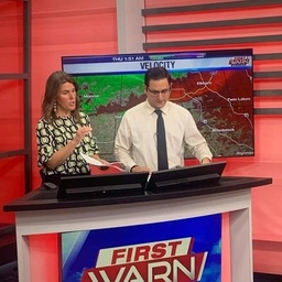
Joey Marino
Morning Meteorologist at WTVO-TV (Rockford, IL)
Morning Meteorologist @Mystateline • @MillersvilleU Grad • Girl dad to Hailey 🩷 • Yankees/Chiefs • I’m probably under the meso somewhere 🌪️
Articles
-
5 days ago |
mystateline.com | Joey Marino
It will be another warm night as overnight lows have fallen back into the mid 70s. As we’ve seen the past few days, these warmer morning have paved the way for dangerous hot afternoons. Same story today. In fact, today will be slightly hotter than the past few days and quite honestly could become the warmest day of the year. Highs are slated to reach the mid-90s, which will place heat indices near or just above 100°.
-
1 week ago |
mystateline.com | Joey Marino
Lots to talk about as we get into the first few couple of the summer season, including storm chances this morning and dangerous heat this weekend. We’re quiet for now. However, a complex of showers and storms pushing through northern Iowa may bring the potential for a few morning storms, primarily from mid-morning to midday. These should weaken on approach, though there could be a narrow window of stronger wind gusts (30-40 mph) immediately behind.
-
1 week ago |
mystateline.com | Joey Marino
Wednesday’s rainfall was much-needed and the most the Rockford Airport has seen since last July. With the storm system responsible for yesterday’s rainfall now to our east, a drier outlooks slides in for the rest of the work week. An area of high pressure sliding into the Midwest will help get rid of any more cloud cover. That will leave us with a decent amount of sun. That, along with a cool northwesterly wind in place will leave afternoon highs rather comfortable in the low 80s.
-
1 week ago |
mystateline.com | Joey Marino
Northern Illinois is waking up to some positive news when it comes to today’s severe threat. With forecast models trending a more south with the overall track of the low, the Storm Prediction Center has lowered our severe threat this afternoon. As of 5AM, most remain under a level 1 Marginal Risk with a sliver of DeKalb County still under the level 2 Slight Risk. Now, further changes are expected as the final details come about with today’s system.
-
1 week ago |
mystateline.com | Joey Marino
As expected, there are a few details that have changed about our upcoming severe chances. Starting with today, thunderstorm chances in nature will be scattered and could arrive as early as the early-afternoon hours. However, it’s between the hours of 5PM-10PM where models show a cluster of storms shifting through the Stateline.
Try JournoFinder For Free
Search and contact over 1M+ journalist profiles, browse 100M+ articles, and unlock powerful PR tools.
Start Your 7-Day Free Trial →X (formerly Twitter)
- Followers
- 2K
- Tweets
- 28K
- DMs Open
- No

Saturday remains dry, though we can expect more clouds and the chance for a few showers to arrive late into Saturday night. Sct'd chances continue Sunday as a cold front is scheduled to sweep through during the afternoon. A few storms are also possible! #ILwx #WIwx @MyStateline https://t.co/jTehWQ231X

Air quality to start is considered "unhealthy for some" as much of the area is observing AQI values above 100. Refrain from spending prolonged periods of time outdoors if you have lung/heart issues. Air quality should slowly improve as the day progresses! #ILwx #WIwx @MyStateline https://t.co/xwY6D88Dmt

TGIF! Friday begins with a little more cloud cover as a batch of sprinkles and light showers pass to our north. Tune in to WTVO 17 & FOX 39 for the latest on your Friday forecast and an update on air quality! #ILwx #WIwx @MyStateline https://t.co/PsVdDQMZgr


