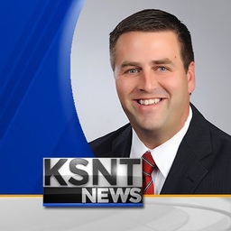
Matt Miller
Storm Track Chief Meteorologist at KSNT-TV (Topeka, KS)
Chief Meteorologist at KSNT Storm Track. For even more weather coverage during times of severe weather, please consider following @KSNTNews.
Articles
-
3 days ago |
ksnt.com | Matt Miller
What We’re TrackingMostly clear nightMainly dry through Tuesday afternoonSeveral rain chances aheadAnother mostly clear sky overnight as temperatures drop back only into the lower 50s with a moderate amount of moisture in the air and a light south breeze. Mostly sunny for much of Tuesday before clouds start to build up, possibly a shower or storm by the evening hours. Highs will climb into the upper 70s to near 80°, as well.
-
3 days ago |
yahoo.com | Matt Miller
What We’re TrackingMostly clear nightMainly dry through Tuesday afternoonSeveral rain chances aheadAnother mostly clear sky overnight as temperatures drop back only into the lower 50s with a moderate amount of moisture in the air and a light south breeze. Mostly sunny for much of Tuesday before clouds start to build up, possibly a shower or storm by the evening hours. Highs will climb into the upper 70s to near 80°, as well.
-
1 week ago |
ksnt.com | Matt Miller
What We’re TrackingBreezy night aheadCooling down a bit FridayOccasional rain and cooler for Easter weekendStrong breezes from the south continue into much of the night with lows only falling into the upper 50s by early Thursday. Wind wills shift as a cold front slides through overnight. With that, temperatures will make a dip for Friday only warming to the upper 60s to near 70°.
-
1 week ago |
ksnt.com | Matt Miller
What We’re TrackingMostly clear nightWarm Wednesday, a few overnight stormsVery warm again on ThursdayMostly clear and cool tonight with temperatures dropping into the middle 40s by morning with light wind, shifting to the south by morning. Highs on Wednesday will climb into the upper 70s after some early clouds move out. Sunny and warmer weather on Wednesday could give way to a couple of isolated storms Wednesday night. Then we clear out Thursday and heat up into the upper 80s and lower 90s.
-
1 week ago |
yahoo.com | Matt Miller
What We’re TrackingChilly start to TuesdayFew showers on WednesdayVery warm again on ThursdayA clear sky with diminishing wind will give us a chilly start to Tuesday. Lows will fall into the middle to upper 30s across the region, with the lowest temperatures to the west. We’ll finally get our wind to back off heading into Tuesday as temperatures slowly warm through the middle of the week. Highs still reach the upper 60s with sunshine Tuesday afternoon.
Try JournoFinder For Free
Search and contact over 1M+ journalist profiles, browse 100M+ articles, and unlock powerful PR tools.
Start Your 7-Day Free Trial →X (formerly Twitter)
- Followers
- 1K
- Tweets
- 4K
- DMs Open
- No

Here's how the next 7 days are shaping up for high temperatures. https://t.co/ArBWPGICwC

Here's the way the weather looks right now in Topeka and Manhattan. https://t.co/3Kpg5GS03s

Here's what to expect later tonight across the area... https://t.co/LDYb4EJAjW