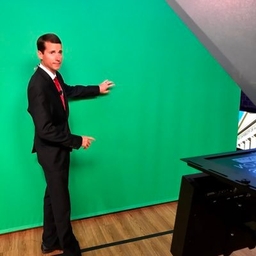
Richard Scott
Chief Meteorologist at WVUA-TV (Tuscaloosa, AL)
I'm the chief meteorologist for WVUA23 in Tuscaloosa. You can find weather updates for west and central Alabama right here...
Articles
-
Mar 28, 2025 |
apr.org | Richard Scott
Alabama meteorologists are warning about severe storms coming to the Yellowhammer State this weekend and into early next week. Damaging winds, hail and frequent lighting are being identified as the main threats during around midnight on Sunday into Monday morning. Weather experts say an isolated tornado is also possible. Local forecasters stress that now is the time to be "," plan ahead for a tornado warning and be prepared to if a tornado develops.
-
Mar 4, 2025 |
apr.org | Richard Scott
Multiple weather threats are looming this week across the U.S., including in Alabama. The Yellowhammer State is in the bullseye for a heightened risk of severe weather as a powerful system moves through the South. Local meteorologists caution that strong storms and possible tornadoes are expected across Alabama tonight (March 4).
-
Feb 14, 2025 |
apr.org | Richard Scott
Alabama meteorologists are warning about severe storms coming to the Yellowhammer State this weekend. Heavy rain, damaging winds and possible tornadoes are in the forecast from Saturday night into Sunday morning, according to the National Weather Service (NWS). With the incoming inclement weather, experts are stressing that Alabamians need to remain "," as some of the more extreme thunderstorms could be life threatening. Residents are being urged to have access to overnight weather alerts.
-
Feb 12, 2025 |
wvua23.com | Richard Scott
At 7:30am, a large rain mass continues to fall across much of Alabama and Mississippi. Rain cooled air will keep the northern half of Alabama stable today. The greatest chance of a severe storm will be south of Moundville and Centreville. The risk is not zero but much lower to the north. An isolated tornado or damaging wind gust will be possible between 2pm and midnight. Again, the better chance will be across southern Alabama where the air will be more unstable.
-
Jan 15, 2025 |
wvua23.com | Richard Scott
Good Tuesday afternoon! Very cold weather arrives on Sunday! Highs drop into the 30s, with lows in the upper teens to lower 20s next week. This, plus, the possibility of a winter storm early next week. Be prepared for the cold weather, as this is pipe-bursting cold. Keep in mind, if we do indeed have snow, this could bring colder temperatures that in the current forecast, especially at night. Some reminders to think about, as we don't often deal with this type of cold in Alabama...
Try JournoFinder For Free
Search and contact over 1M+ journalist profiles, browse 100M+ articles, and unlock powerful PR tools.
Start Your 7-Day Free Trial →X (formerly Twitter)
- Followers
- 5K
- Tweets
- 46K
- DMs Open
- No

#SPC issues Day 1 Marginal Convective Risk at Jun 18, 16:19z for BMX https://t.co/LOMISVdPji https://t.co/hopq8L9DoE

#SPC issues Day 1 Marginal Convective Risk at Jun 18, 12:54z for BMX https://t.co/Muhl9lkQ0m https://t.co/kdCqcG2mNp

WPC issues Day 2 Marginal Risk Excessive Rainfall Outlook at Jun 18, 7:58z for BMX https://t.co/ZQDhP8wRzz https://t.co/BG3ngxUpOk