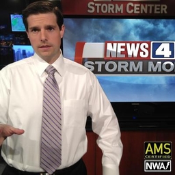
Steve Templeton
Chief Meteorologist at KMOV-TV (St. Louis, MO)
Chief Meteorologist #KMOV #STL. Love active wx, it's when my job is most important. Love BBQ & most of all family. Two kids keep me smiling & tired
Articles
-
1 week ago |
firstalert4.com | Steve Templeton
First Alert Weather Days for Heat Saturday-TuesdayWeekend Heat Index Up To 105°A Dry Stretch Until next WeekDownload the Free First Alert Weather App HereFriday: We’ll ease into hotter and slightly more humid air tomorrow with a high around 93 and a heat index of 97 under mostly sunny skies. First Alert Weather Days For Dangerous Heat & Humidity This Weekend Through Tuesday: Temperatures will ramp up quickly this weekend with highs in the mid-upper 90s from Saturday through Tuesday.
-
1 week ago |
firstalert4.com | Steve Templeton
First Alert Weather Day Today - Severe Storm Potential This Afternoon & Early EveningFirst Alert Weather Days Added This Weekend Into Monday For Intense HeatHeat Index Over the Weekend & Monday Up to 105°Download the Free First Alert Weather App HereThere is a Tornado Watch in effect until 4 p.m. for a handful of counties in Illinois. Remember: A Tornado Watch means that conditions are favorable for the development of dangerous thunderstorms that could produce strong winds, hail, and tornadoes.
-
1 week ago |
firstalert4.com | Steve Templeton
First Alert Weather Day Continues For This EveningA Few Storms This Evening, Isolated Severe RiskFirst Alert Weather Days Added This Weekend Into Monday For Intense HeatHeat Index Over the Weekend & Monday Up to 105°Download the Free First Alert Weather App HereThis evening a few scattered storms will develop as the cold front moves through. Enough storm fuel may redevelop to allow for an isolated severe storm or two.
-
1 week ago |
firstalert4.com | Steve Templeton
Wednesday Is A First Alert Weather Day - Severe Storms PossibleFirst Alert Days Saturday & Sunday For HeatBig Heat This Weekend, heat Index Near 105Download the Free First Alert Weather App HereTonight: An isolated shower or storm is possible coming from the north this evening. These wouldn’t be severe and the chances are low. Otherwise expect a muggy evening.
-
1 week ago |
firstalert4.com | Steve Templeton
Few T’Showers Southeast of St. Louis This EveningWednesday Is A First Alert Weather Day - Severe Storms PossibleBig Heat For The WeekendDownload the Free First Alert Weather App HereTonight: A few thundershowers will remain possible this eveneing south and east of St. Louis. They won’t be severe but there could be some redevelopment of cells in one area where you could see some isolated flooding. Again these will remain south/east of St. Louis. They taper off by daybreak.
Try JournoFinder For Free
Search and contact over 1M+ journalist profiles, browse 100M+ articles, and unlock powerful PR tools.
Start Your 7-Day Free Trial →X (formerly Twitter)
- Followers
- 13K
- Tweets
- 28K
- DMs Open
- No

We need your help! At Chaminade now collecting donations for tornado relief. This goes until 2pm today and if you’re able to help, check the link for items we’re collecting. Thank you St. Louis for caring about our community! https://t.co/Tl4oZTcawk #FirstAlert4 https://t.co/ubg7w1apNr

Weak funnel seen in Arnold today. Harmless but a little spin on this cell. We'll monitor it just in case. #FirstAlert4 https://t.co/Xx9F47YSFg

For Friday: Scat'd showers around for the AM drive, then in the afternoon-early evening keep an eye on radar so you don’t get caught in a quick downpour. It will be very humid and that tropical humidity can help make for brief downpours, though severe weather is not expected https://t.co/97oX8orRUC