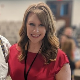
Aubrey Urbanowicz
Chief Meteorologist at WHSV-TV (Harrisonburg, VA)
Contributor at WeatherBrains
Articles
-
6 days ago |
wvva.com | Aubrey Urbanowicz |Sam Read
BRISTOL, R.I. (WJAR) – This summer marks the 50th anniversary of the iconic film “Jaws.”In celebration, a Rhode Island man is working on a passion project related to the thriller, and it’s getting a big following. In his Bristol neighborhood, Louis Sauzedde is working with wood. For as long as he can remember, he’s had a love of lumber. Coupled with his boat-building and repair skills, Sauzedde’s hobby has made for a fun career. “My father was a commercial fisherman,” he said.
-
6 days ago |
azfamily.com | Aubrey Urbanowicz |Sam Read
BRISTOL, R.I. (WJAR) – This summer marks the 50th anniversary of the iconic film “Jaws.”In celebration, a Rhode Island man is working on a passion project related to the thriller, and it’s getting a big following. In his Bristol neighborhood, Louis Sauzedde is working with wood. For as long as he can remember, he’s had a love of lumber. Coupled with his boat-building and repair skills, Sauzedde’s hobby has made for a fun career. “My father was a commercial fisherman,” he said.
-
1 week ago |
whsv.com | Aubrey Urbanowicz
LYNDHURST, Va. (WHSV) - It’s a tornado in the National Weather Service record books, but there’s no defined path. In fact there are 4 tornadoes recorded on the evening of June 5, 1975 and all are officially recorded as F-0 tornadoes (old rating system, wind 40-72mph) and the path as less than 0.1 mile. There were numerous storms that night as a squall line moved across the region. There were reports of 60-70 mph wind gusts and multiple trees down across several states.
-
2 weeks ago |
whsv.com | Aubrey Urbanowicz
(WHSV) - Wildfire smoke in the upper levels of the atmosphere can get transported by the Jetstream, and that’s how smoke can be brought into our area from wildfires so far away. AlertsThis can affect air quality. The sky will look more hazy. The smoke can also add some more vibrant colors at sunrise and sunset. At times, just looking more unique. SMOKE AND HAZE FORECASTHere’s a look at the smoke forecast for the next few days. AIR QUALITYCopyright 2022 WHSV. All rights reserved.
-
2 weeks ago |
whsv.com | Aubrey Urbanowicz
STANLEY, Va. (WHSV) - Stanley is actually no stranger to tornadoes. There have been four tornadoes in the towns past. All four went right through town. Starting in 1925, 1954, 1993 and 2009. A tornado touched down at the intersection of Pond Avenue and Dogwood Lane. The path length was one and two-thirds of a mile and the path width was 600 yards.
Try JournoFinder For Free
Search and contact over 1M+ journalist profiles, browse 100M+ articles, and unlock powerful PR tools.
Start Your 7-Day Free Trial →Coverage map
X (formerly Twitter)
- Followers
- Tweets
- DMs Open

Scattered showers are working in for the afternoon. Locally heavy at times https://t.co/9Vql6vKSND

RT @severeforecast: Severe storm from just a minute going over Smith Mountain Lake, Virginia. Solid blue colors in the core! #vawx https://…

The National Weather Service has issued a Flash Flood Warning until 6/15 8:00PM for the following counties: Augusta. Avoid being in a vehicle during flash flooding @WHSVnews https://t.co/oXofBpIuei
