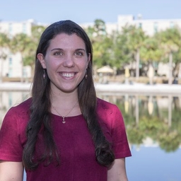
Irene Sans
Bilingual Digital #Meteorologist 📲Editorial Mgr @WeatherRadar_US @ametsoc #CDM & #CBM & Board/Cmte Member /Int'l Consultant /Emmy winner☀
Articles
-
2 weeks ago |
wqcs.org | Irene Sans
Plenty of moisture is streaming in from the Gulf, controlled by a high-pressure system located east of Florida (remember, high-pressure systems spin clockwise, so the moisture is coming in from the south-southwest over northern Florida). This moisture and a series of fronts approaching the Panhandle and North Florida will increase the chance of showers and storms for the rest of the weekend and early next week.
-
2 weeks ago |
wuwf.org | Irene Sans
Plenty of moisture is streaming in from the Gulf, controlled by a high-pressure system located east of Florida (remember, high-pressure systems spin clockwise, so the moisture is coming in from the south-southwest over northern Florida). This moisture and a series of fronts approaching the Panhandle and North Florida will increase the chance of showers and storms for the rest of the weekend and early next week.
-
2 weeks ago |
wusf.org | Irene Sans
Plenty of moisture is streaming in from the Gulf, controlled by a high-pressure system located east of Florida (remember, high-pressure systems spin clockwise, so the moisture is coming in from the south-southwest over northern Florida). This moisture and a series of fronts approaching the Panhandle and North Florida will increase the chance of showers and storms for the rest of the weekend and early next week.
-
2 weeks ago |
southcarolinapublicradio.org | Irene Sans
An extensive cold front will continue to inch closer to the Southeast this weekend. There is a chance for severe thunderstorms to occur across South Carolina through the beginning of the week. Overall, there’s a slight risk for severe storms for Saturday through Monday, but more activity is probable beyond the start of the week. Saturday evening: A severe thunderstorm watch is in effect for the Upstate. It will be valid until 9 p.m. Saturday, as severe thunderstorms will push from east to west.
-
3 weeks ago |
wusf.org | Irene Sans
June is full of events. Most notably, we officially welcome the start of the Atlantic hurricane season. As we know, tropical storms can develop if we have certain ingredients and dynamics in the atmosphere. First, water temperatures need to be at least 80°F to provide enough water vapor for storms to get started. Once we have a cluster of storms, we need them to organize. As the storms become better organized, we need windshear, the change of wind direction with height, to stay relatively low.
Journalists covering the same region

Jeffrey Meesey
Multimedia Desk Editor at Florida Today
Jeffrey Meesey primarily covers news in Central Florida, including areas around Orlando and Tampa, United States.

Stephanie Colombini
Producer and Reporter at WUSF-FM (Tampa, FL)
Stephanie Colombini primarily covers news in Central Florida, United States, including areas around Tampa and Orlando.

Octavio Jones
Photographer at Freelance
Octavio Jones primarily covers news in Central Florida, including Orlando and surrounding areas like Tampa and Lakeland, United States.

Steven Walker
Education Reporter at Orlando Sentinel
Steven Walker primarily covers news in Orlando, Florida, United States and surrounding areas including Kissimmee and Winter Park.
Madison Skowronski
Writer at WDW News Today
Madison Skowronski primarily covers news in Orlando, Florida, United States and surrounding areas.
Try JournoFinder For Free
Search and contact over 1M+ journalist profiles, browse 100M+ articles, and unlock powerful PR tools.
Start Your 7-Day Free Trial →Coverage map
X (formerly Twitter)
- Followers
- 9K
- Tweets
- 41K
- DMs Open
- No

RT @janethleontv: Tres turistas fueron arrastrados por el fuerte oleaje en una playa de #Acapulco , a pesar de las advertencias por el fenó…

RT @NOAAResearch: JUST IN: Atmospheric carbon dioxide (CO2) concentrations have peaked for the year at 430.5 ppm.📈 This is 3.6 ppm higher t…

RT @JohnMoralesTV: “…as meteorologists find their voices on all of our behalf, it is important to understand that they are well-trained pro…