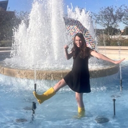
Kristin Walla
Weekend Meteorologist at KIII-TV (Corpus Christi, TX)
@kiii3news Meteorologist • TAMU ‘21 • coffee & cloud enthusiast • not the golfer
Articles
-
1 month ago |
kiiitv.com | Kristin Walla
Last night, severe thunderstorms moved through the Coastal Bend. Those storms originated to our north and grew upscale into what's called a mesoscale convective system (a line of storms) as it came through. Sections of the line bulged and bowed forward as strong winds from within the storm rushed down to the surface. These are the winds that caused numerous power outages and damage across parts of the Coastal Bend.
-
1 month ago |
kiiitv.com | Kristin Walla
CORPUS CHRISTI, Texas — Last night, severe thunderstorms moved through the Coastal Bend. Those storms originated to our north and grew upscale into what's called a mesoscale convective system (a line of storms) as it came through. Sections of the line bulged and bowed forward as strong winds from within the storm rushed down to the surface. These are the winds that caused numerous power outages and damage across parts of the Coastal Bend.
-
Mar 12, 2025 |
kiiitv.com | Kristin Walla
Tomorrow night, there's something really cool happening in the sky - a total lunar eclipse! Lunar eclipses occur when the Earth is positioned between the Sun and Moon, so that the Moon is eclipsed by Earth's shadow. In the case of a total lunar eclipse, the Moon is completely within the darkest part of the Earth's shadow.
-
Mar 7, 2025 |
kiiitv.com | Kristin Walla
CORPUS CHRISTI, Texas — We'll see heightened fire danger again tomorrow. Another dryline will move through the Coastal Bend tomorrow morning and afternoon ahead of a cold front. This will significantly drop humidity levels across the area - specifically in those communities behind the dryline (to the west). In addition to the low humidity levels and drought conditions, inland winds will become breezy again at 10-20 mph with gusts to 30 mph.
-
Feb 19, 2025 |
kiiitv.com | Kristin Walla
CORPUS CHRISTI, Texas — We have issued a Weather Impact Alert for tonight due to expected freezing temperatures and dangerously cold wind chill values. Make sure to dress warmly, in layers, and to protect the four Ps. We also have Weather Impact Alerts through Saturday morning for the continuing very cold wind chills. Last night's cold front came in a bit colder than expected across much of Texas, including here in the Coastal Bend.
Try JournoFinder For Free
Search and contact over 1M+ journalist profiles, browse 100M+ articles, and unlock powerful PR tools.
Start Your 7-Day Free Trial →Coverage map
X (formerly Twitter)
- Followers
- 947
- Tweets
- 3K
- DMs Open
- Yes

Rain chances have been a little back and forth as models try to resolve what this week's forecast holds. Upper-level energy's placement and proximity to the Coastal Bend will determine what our rain chances look like later this week. We'll keep you updated. https://t.co/53mfaAyjyH

With highs approaching near-record temperatures tomorrow, it'll be a nice day to head out to the beach to beat the heat. Just remember the sunscreen and to drink plenty of water! https://t.co/x8oEOPcWMy

This weekend looks hot and humid! Expect hazy skies the next couple days as Saharan dust moves in. https://t.co/fHW73XrFMz