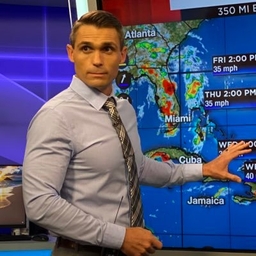
Luke Dorris
Chief Meteorologist at KCTV-TV (Kansas City, MO)
Saved by grace ✝️, husband to the girl of my dreams, dad to one boy and twin girls, KCTV Chief Meteorologist, IL➡️OK➡️NE➡️FL➡️KC AMS CBM #642
Articles
-
Mar 12, 2025 |
ourcommunitynow.com | Luke Dorris
Share KANSAS CITY, Mo. (KCTV) - The weather streak we are currently in is nothing short of spellbinding. It just doesn’t get much better than 70s, sunshine, light winds, and low humidity. We want to get Friday and Saturday on your radar, as we are First Warning both days as a powerful storm system arrives. With it comes very high winds, a chance for severe thunderstorms, and a 20°+ drop in temperatures. Starting with Wednesday, we kick it off with morning temperatures in the mid-40s.
-
Jun 5, 2024 |
thepitchkc.com | Zach Gunter |Joe Lauria |Luke Dorris
Kansas City urban legend suggests that the small Kansas town of Tonganoxie plays a big part in the weather of the city. The "Tonganoxie Split," as it's called, states that a storm cell "splits" as it moves toward the heart of the metro. A number of citizens find this to be true. Reddit-specifically the Kansas City page-and other message boards crawl with people claiming that this phenomenon exists. The Tonganoxie Split is real.
-
Dec 17, 2023 |
local10.com | Luke Dorris
Published: December 17, 2023 at 7:32 PMSign up for our NewslettersRELATED STORIESPublished: December 17, 2023 at 7:32 PMFlorida temperatures to lower to 40s, 50s, 60sRead More Video Player is loading. Duration 0:00Current Time 0:00 Remaining Time -0:00Beginning of dialog window. Escape will cancel and close the window. TextColorTransparencyBackgroundColorTransparencyWindowColorTransparencyFont SizeText Edge StyleFont FamilyEnd of dialog window.
-
Jul 24, 2023 |
local10.com | Luke Dorris
Sign up for our NewslettersEl sistema, designada Invest 95L, tuvo probabilidades de hasta el 70% el viernes desde el NHC hasta la depresión tropical 6, o posiblemente la tormenta tropical Emily. Esas probabilidades se han reducido ahora a sólo un 20%. Si las tormentas cerca del centro no se pueden mantener, entonces el ciclo de desarrollo tropical no puede tener lugar. El ciclo va; Las tormentas cerca del centro liberan calor en el aire que se recogió del mar.
-
Jul 24, 2023 |
local10.com | Luke Dorris
Sign up for our NewslettersTropical disturbance in Atlantic on the move westward, but has struggled to maintain thunderstorms near center of low pressureThe disturbance, designated Invest 95L, had odds as high as 70% on Friday from the NHC to form into Tropical Depression 6, or possibly Tropical Storm Emily. Those odds have now been dropped to just 20%. If the storms near the center can’t be maintained, then the tropical development cycle cannot take place.
Journalists covering the same region

Craig Ritchie
North America Correspondent at International Boat Industry
Craig Ritchie primarily covers news in Miami, Florida, United States and surrounding areas.

Alex Harris
Climate Change Reporter at Miami Herald
Alex Harris primarily covers news in Miami, Florida, United States and surrounding areas including the Florida Keys.

Shayne Benowitz
Writer, Editor and Consultant at Freelance
Shayne Benowitz primarily covers news in Miami, Florida, United States and surrounding areas.

Gary Alan Ruse
Writer at Miami's Community Newspapers
Gary Alan Ruse primarily covers news in Miami, Florida, United States and surrounding neighborhoods.

Soledad Cedro
Fill-in Host and Political Analyst and Advisor at Freelance
Soledad Cedro primarily covers news in Miami, Florida, United States and surrounding areas including Fort Myers and the Florida Keys.
Try JournoFinder For Free
Search and contact over 1M+ journalist profiles, browse 100M+ articles, and unlock powerful PR tools.
Start Your 7-Day Free Trial →Coverage map
X (formerly Twitter)
- Followers
- 4K
- Tweets
- 21K
- DMs Open
- No

One of the very rare instances where the risk of tornadoes isn’t the highest concern of the day. The severe setup in NW TX & Southern OK is just bonkers. Straight line winds to 105 mph and gargantuan 5” hail possible. It’s a *particularly dangerous situation* https://t.co/IWZEwa0Wbf
RT @Patrick55636327: Utica Mo, quite the downpour, already over an inch of rain. @fox4wx @AlexCounteeWX @WarrenKCTV5 @LukeDorris @MikeNicc…
RT @WarrenKCTV5: Flash Flood Warning issued for Caldwell, Clinton, Daviess and Dekalb counties until 6:45 PM. Multiple inches of rain has f…

