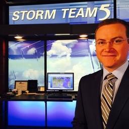
Luke Sampe
Chief Meteorologist at WFRV-TV (Green Bay, WI)
A father, husband, met. This is my personal X account - I don't just stick to weather. WI homer sports takes only. My happy place is anywhere on the water.
Articles
-
2 weeks ago |
wearegreenbay.com | Luke Sampe
It’s now mid June – but you wouldn’t know it based on our latest downturn in temperatures and passing rain showers. It’s like April came right back to NE WI. Unfortunately for the northwoods, it appears there will be more spotty showers on Saturday. Partly sunny south with a smaller chance for rain and a high in the mid to upper 60s . Cooler where it rains. It’s big day in Appleton with the Flag Day parade – thankfully any rain chances look to be light and brief, it any.
-
2 weeks ago |
wearegreenbay.com | Luke Sampe
Sunday will start dry, but a cold front cutting across the state will bring with it a line of rain and thunderstorms, beginning in the late morning and ending by the late afternoon. Then we will watch for a few more isolated thunderstorms to pop up during the evening. Severe weather is not expected. Highs will sit in the low 70s. The upper level low from this system will rotate in on Monday, likely bringing more scattered showers and storms on Monday.
-
4 weeks ago |
wearegreenbay.com | Luke Sampe
Thunderstorm chances: A cold front will flare up spotty showers or thunderstorms into this evening. There is a low chance for any particular county to see a strong/severe thunderstorm, but in addition to lightning and isolated downpours, some small hail or a strong wind gust may come from any storm. Stay tuned to Local 5 News or our Storm Team 5 Weather app where we will alert you of any Severe Thunderstorms.
-
1 month ago |
wearegreenbay.com | Luke Sampe
Following the active evening of thunderstorms and severe weather Thursday night, Friday is starting out pretty nice with sunshine. It’s going to be our last day of summer-like heat for a while as temperatures return to the upper 70s and lower 80s away from the lake. Cooler weather in the 50s and 60s for the next week.
-
1 month ago |
wearegreenbay.com | Luke Sampe
If you like the weather for Saturday, it gets even better Sunday. Mostly sunny, temperatures in the middle and upper 60s, possibly reaching 70 in a few spots. Cooler by the lake once again, only reaching the upper 50s. An omega blocking pattern is beginning to take shape in the upper levels, and for us in northeast Wisconsin, this brings us above average temperatures and drier than normal conditions.
Try JournoFinder For Free
Search and contact over 1M+ journalist profiles, browse 100M+ articles, and unlock powerful PR tools.
Start Your 7-Day Free Trial →Coverage map
X (formerly Twitter)
- Followers
- 6K
- Tweets
- 61K
- DMs Open
- No

“The league has come to terms…” Lol.

Giannis Antetokounmpo is staying with the Milwaukee Bucks, per @WindhorstESPN “The league has come to terms with the real realization that the Bucks are going to keep him in. Giannis is not going to ask for a trade.” (via @GetUpESPN) https://t.co/8C0FmcWNW4

Accurate.

https://t.co/YoDEan65Ev

RT @BookOfEli_NFL: This will never not be funny https://t.co/M1liRb6GW0


