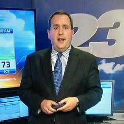
Mark Henderson
Chief Meteorologist at WIFR-TV (Rockford, IL)
Chief Meteorologist @23WIFR, @ValpoU Grad, Weather Weenie, Sports Enthusiast, Foodie. Opinions expressed here are my own, not those of WIFR nor its employees.
Articles
-
3 days ago |
wifr.com | Mark Henderson
ROCKFORD, Ill. (WIFR) - The Stateline saw its warmest temperatures of 2025 to date Monday, and the warmth is far from finished. However, in contrast to the quiet trend that’s been prevalent for the past week, our pattern’s to take a turn for the more unsettled in the coming days.
-
1 week ago |
wifr.com | Mark Henderson
ROCKFORD, Ill. (WIFR) - Chillier temperatures have returned to the Stateline, and those planning on heading outdoors through early Friday morning will want to reach for the jacket before doing so. Clear skies and lighter winds Thursday night will allow temperatures to fall very quickly overnight, and by early Friday morning, temperatures are likely to have fallen into the middle 30s. With such temperatures, it’s possible frost may form in many spots.
-
1 week ago |
wifr.com | Mark Henderson
ROCKFORD, Ill. (WIFR) - For the first time in a week, temperatures returned to the 70s across northern Illinois and southern Wisconsin, and we can rest assured that we will not be waiting another week for our next day in the 70!Bright sunshine is expected to dominate for a second straight day Wednesday as temperatures surge into the middle 70s by midday. Watch out, however, for a wind shift to take place in the afternoon, which will result in a rather precipitous drop in temperatures.
-
1 week ago |
wifr.com | Mark Henderson
ROCKFORD, Ill. (WIFR) - May has gotten off to a somewhat cool and unsettled start, but the light at the end of the tunnel is shining very brightly as a new week begins. A nearly stationary upper level low pressure system, responsible for the persistent cloudiness, occasional showers, and cooler than normal temperatures is now beginning a slow exit eastward. As that began late Monday afternoon and early Monday evening, our skies have been turning brighter in rapid fashion.
-
2 weeks ago |
wifr.com | Mark Henderson
ROCKFORD, Ill. (WIFR) - Temperatures in the Stateline have been heading in the wrong direction as the week has gone on. From Monday’s 80s to Tuesday’s 70s and then Wednesday’s 60s, the downward spiral continued Thursday, with highs reaching only the middle 50s. Unfortunately, as a trough of upper level low pressure remains nearly cemented overhead for the next several days, we may be stuck in a chilly, unsettled rut for several more days.
Try JournoFinder For Free
Search and contact over 1M+ journalist profiles, browse 100M+ articles, and unlock powerful PR tools.
Start Your 7-Day Free Trial →X (formerly Twitter)
- Followers
- 3K
- Tweets
- 18K
- DMs Open
- No