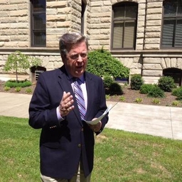
Chris Bailey
Chief Meteorologist at WKYT-TV (Lexington, KY)
WKYT Chief Meteorologist. Longest tenured meteorologist with Gray Media (27 years) Emmy Wins Multi AP & KBA Ky Meteorologist of the year Multi Edward R Murrow
Articles
-
3 weeks ago |
wkyt.com | Chris Bailey
LEXINGTON, Ky. (WKYT) - Severe weather seems to show up on Friday’s here in Kentucky and the threat is with us again out there today as a cold front moves in and slows down. This keeps the threat for strong to severe storms going into the first half of the weekend. The boundary stalling out allows a few waves of low pressure to roll through here, touching off showers and storms. This is NOT widespread action where it rains and rains and rains.
-
3 weeks ago |
wkyt.com | Chris Bailey
LEXINGTON, Ky. (WKYT) - We have a front nearing the area from the west and it’s touching off a few storms out there today. This boundary slows down with a few waves of low pressure causing showers and storms to increase. Some of these may be strong or severe. Temps today reach the 80s with a mix of sun and clouds. Humidity levels inch up just a bit as scattered showers and storms go up. There’s even the chance for a strong or severe storm across the west and north.
-
3 weeks ago |
wkyt.com | Chris Bailey
LEXINGTON, Ky. (WKYT) - Summertime air is back in the Bluegrass state and I don’t think too many people are going to complain. The complaints will likely show up in the coming days as rounds of showers and storms fire back up. Temps today reach 85-90 in most areas with a mix of sun and clouds. There’s the chance for a shower or storm in the west and north. The threat for showers and storms will then increase Thursday as a front approaches from the northwest and slows down.
-
4 weeks ago |
mondaq.com | Chris Bailey
From a U.S. bankruptcy perspective, distressed debt investing is often based on two fundamental principles in the bankruptcy system: 1) a secured creditor is entitled to the value of its collateral in a given bankruptcy case (and subject to any court-imposed limitations, entitled to credit bid its debt in connection with a bankruptcy sale of such collateral) and 2) absent consent of senior classes, a plan of reorganization may not allocate any property to a junior class, on account of such...
-
1 month ago |
wkyt.com | Chris Bailey
LEXINGTON, Ky. (WKYT) - Rounds of showers and storms continue to target much of the region today, bringing a local high water threat for some. This action comes as low pressure spins in from the southwest and moves right on top of us. These showers and storms will target central and eastern Kentucky through tonight, putting down quite a bit of rain. A general 1″-3″ of rain is likely to show up with the chance for some locally higher amounts.
Journalists covering the same region

Gil McClanahan
General Assignment Reporter at WCHS-TV (Charleston, WV)
Gil McClanahan primarily covers news in the Central Appalachian region, including areas in Kentucky and West Virginia, United States.
John Caulfield
Senior Editor at Building Design & Construction
John Caulfield primarily covers news in New York City, New York, United States and surrounding areas.
Ciera Hughes
Staff Reporter at Franklin County Times
Ciera Hughes primarily covers news in Ohio, United States, particularly in areas around Columbus and surrounding regions.

Noelle Maxwell
Journalist at Freelance
Noelle Maxwell primarily covers news in Indiana and surrounding areas, including parts of Ohio and Kentucky.

Matt Foster
UK Deputy Editor at POLITICO Europe
Matt Foster primarily covers news in various locations across New York and Pennsylvania, United States, including cities like New York City and surrounding areas.
Try JournoFinder For Free
Search and contact over 1M+ journalist profiles, browse 100M+ articles, and unlock powerful PR tools.
Start Your 7-Day Free Trial →Coverage map
X (formerly Twitter)
- Followers
- 128K
- Tweets
- 168K
- DMs Open
- Yes

RT @danpend3500: Raining hard on US27 in Garrard and Jessamine counties this late #Sunday afternoon. @jsmithwx @thekyniche @jloganwxguy @NW…

Flash Flood Warning for Boyd and Greenup counties until 8:30 PM #KYWX

Flash Flood Warning for Owsley County until 8pm. #kywx