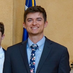
Jack Gerfen
Chief Meteorologist at KOKH-TV (Oklahoma City, OK)
Chief Meteorologist at KOKH FOX 25 in Oklahoma City. If I'm not forecasting, I'm detailing my car!
Articles
-
2 weeks ago |
okcfox.com | Jack Gerfen
The forecast calls for little in the way of severe weather next week, but we have to get through one last day before we can enjoy some drier weather. Unfortunately, Sunday's chance for severe weather will be quite significant as storms could produce extremely large hail, a few tornadoes, and damaging winds. It'll be the wind threat that we are most concerned about Sunday afternoon and evening.
-
2 months ago |
ktul.com | Jack Gerfen
TOPICS:Severe WeatherStormsFlash FloodingCold FrontEaster WeekendHailRainThunderstormsThe start to April has been very pleasant and quiet, but we knew at some point that was going to change. We believe that change does occur starting on Friday, when strong to severe storms will be possible over much of the area. The rest of the Easter weekend may not see so many severe storms, but we could be looking at a flooding threat due to multiple rounds of storms.
-
2 months ago |
okcfox.com | Jack Gerfen
We are not done with the severe weather chances, unfortunately. We still have a round early Friday morning, another round later in the day, and even potentially early Saturday morning. After that, cooler temperatures will return, bringing with it a chance of a rain/snow mix to Oklahoma!The chance of severe storms will be possible early Friday morning. For us, our main threats will be the hail and wind potential in the morning.
-
2 months ago |
okcfox.com | Jack Gerfen
In just a few hours, we'll be watching the chance for isolated supercell thunderstorms that could produce winds of 60 to 80 mph, up to baseball size hail, and even tornadoes. Have multiple ways of receiving alerts and know your severe weather plan!A Tornado Watch has just been issued for most of the area until Midnight tonight. It may not have felt like a severe weather day, but strong winds out of the south have been bringing in warm, moist air from the south.
-
Mar 17, 2025 |
okcfox.com | Jack Gerfen
Oklahoma has been ravaged by wildfires since Friday, and unfortunately, they remain a possibility all the way through Wednesday. This is due to the combination of the warm temperatures, dry air and fuels, and windy conditions. Super Scoopers have been trying to extinguish the flames in southeast Logan County most of Monday. They have been stationed in Oklahoma since last week. Most of the fires are at least partially contained.
Journalists covering the same region

Sydnee Batzlaff
Reporter at KFOR-TV (Oklahoma City, OK)
Sydnee Batzlaff primarily covers news in Oklahoma City, Oklahoma, United States and surrounding areas.

James Jackson
Writer at 247Sports
James Jackson primarily covers news in Norman, Oklahoma, United States and surrounding areas.

Kyle Phillips
Photojournalist at The Norman Transcript
Kyle Phillips primarily covers news in Norman, Oklahoma, United States and surrounding areas.

Carson Field
Editor and Sports Reporter at The Gazette (Colorado Springs)
Carson Field primarily covers news in Norman, Oklahoma, United States and surrounding areas.

Joleen Chaney
Co-Anchor and Reporter at KFOR-TV (Oklahoma City, OK)
Joleen Chaney primarily covers news in central Oklahoma, including areas around Oklahoma City and surrounding towns.
Try JournoFinder For Free
Search and contact over 1M+ journalist profiles, browse 100M+ articles, and unlock powerful PR tools.
Start Your 7-Day Free Trial →Coverage map
X (formerly Twitter)
- Followers
- 2K
- Tweets
- 22K
- DMs Open
- No

Storms out there tonight could still have sections of severe warnings on it, but flooding is looking to be our main threat now going into the morning hours of our Sunday. #okwx https://t.co/uBN5eEgd0D

Storms this evening are producing quite the light show out there! #okwx

Storms are now moving into Oklahoma County where a new Severe Thunderstorm Warning was issued until 12:15 AM for radar indicated 60 mph winds and 1" hail. Moving southeast at 25 mph. #okwx https://t.co/3a29iZexmw