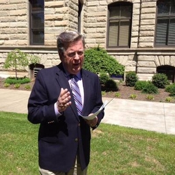
Jim Caldwell
Meteorologist at WKYT-TV (Lexington, KY)
I've been doing TV weather since I was a kid. I still haven't grown up. AM/Noon Meteorologist @WKYT & former @WYMT Chief Meteorologist Snapchat: jcaldwellwx
Articles
-
3 weeks ago |
wkyt.com | Jim Caldwell
LEXINGTON, Ky. (WKYT) - It’s starting to feel like severe weather has a standing Friday appointment here in Kentucky, and once again, we’re dealing with that threat today. A cold front is pushing in and then stalling out, which keeps the chance for strong to severe storms going right into the first part of the weekend. As that front lingers, a few waves of low pressure ride along it, sparking rounds of showers and storms.
-
3 weeks ago |
wkyt.com | Jim Caldwell
LEXINGTON, Ky. (WKYT) - We’ve got a front working its way in from the west today, and it’s already sparking off a few thunderstorms across parts of the region. As this boundary slows down, a couple of waves of low pressure ride along it, leading to an uptick in showers and storms. Some of those could be on the strong or even severe side. Temperatures climb into the 80s this afternoon under a mix of sun and clouds, and humidity is creeping up just enough to make things feel more summery.
-
3 weeks ago |
wkyt.com | Jim Caldwell
LEXINGTON, Ky. (WKYT) - Summer heat is back in full swing across the Bluegrass, and after the cooler stretches we’ve had lately, most folks are likely welcoming this warm-up with open arms. It feels like true summertime out there again—but as is often the case this time of year, that heat comes with a price. A more active and stormy pattern is just around the corner, and it could stick with us for quite a while.
-
3 weeks ago |
wkyt.com | Jim Caldwell
LEXINGTON, Ky. (WKYT) - The hottest air of the summer so far is pushing into the Commonwealth today and will stick around for the next few days. But don’t get too comfortable—this warm-up is setting the stage for a stormier pattern by the end of the week. Highs today will climb into the 80s statewide, with western Kentucky possibly flirting with the 90-degree mark.
-
3 weeks ago |
wkyt.com | Jim Caldwell
LEXINGTON, Ky. (WKYT) - As a blanket of smoke lingers in the sky, signaling the return of hazy conditions, summer-like warmth is beginning to settle in across the region. This surge of warm air marks the hottest stretch of the year so far and will play a major role in setting off an increasingly active weather pattern. By the end of this week, we’ll transition into a stormy setup that shows no signs of letting up into next week.
Journalists covering the same region

Gil McClanahan
General Assignment Reporter at WCHS-TV (Charleston, WV)
Gil McClanahan primarily covers news in the Central Appalachian region, including areas in Kentucky and West Virginia, United States.
John Caulfield
Senior Editor at Building Design & Construction
John Caulfield primarily covers news in New York City, New York, United States and surrounding areas.
Ciera Hughes
Staff Reporter at Franklin County Times
Ciera Hughes primarily covers news in Ohio, United States, particularly in areas around Columbus and surrounding regions.

Noelle Maxwell
Journalist at Freelance
Noelle Maxwell primarily covers news in Indiana and surrounding areas, including parts of Ohio and Kentucky.

Matt Foster
UK Deputy Editor at POLITICO Europe
Matt Foster primarily covers news in various locations across New York and Pennsylvania, United States, including cities like New York City and surrounding areas.
Try JournoFinder For Free
Search and contact over 1M+ journalist profiles, browse 100M+ articles, and unlock powerful PR tools.
Start Your 7-Day Free Trial →Coverage map
X (formerly Twitter)
- Followers
- 28K
- Tweets
- 35K
- DMs Open
- Yes

RT @NWSSevereTstorm: A severe thunderstorm watch has been issued for parts of Kentucky until 7 PM EDT https://t.co/IOVFJkJvs5

RT @NWStornado: A tornado watch has been issued for parts of Kentucky, Tennessee, Virginia and West Virginia until 8 PM EDT https://t.co/nl…

RT @JohnnyRayFeltn1: Doe creek road in Estill Co @nwsjacksonky @cjwxguy56 @Kentuckyweather @JimWKYT @AlexaMintonWX https://t.co/Qkmm1Dgzl3