
Mallory Schnell
Chief Meteorologist at WHAS-TV (Louisville, KY)
Chief Meteorologist @WHAS11 🌦️ @ametsoc CBM ⚡️ @WKU Grad 🎓 KY Native 🐎 Previously: @KOLDNews @WOWT6News @WTVM 📺 Follow me on Facebook!
Articles
-
3 weeks ago |
whas11.com | Mallory Schnell
LOUISVILLE, Ky. — Several waves of showers and storms will impact Kentucky and southern Indiana Today, especially during the afternoon and evening. The reason for another severe weather event just four days after Friday's event, is due to a warm front over the Ohio Valley. This warm front will be combining with a strong upper level jet stream and deep moisture. There is a level 3 out of 5 threat for severe thunderstorms, with the main threat being damaging winds and heavy downpours.
-
1 month ago |
whas11.com | Mallory Schnell
LOUISVILLE, Ky. — The heat and humidity will continue to build this week as summer-like weather returns to Kentucky and southern Indiana. This combination will fuel thunderstorm potential, peaking on later this afternoon. Scattered storms will still continue periodically through the morning, Kentuckiana will experience some dry time midday through the afternoon.
-
1 month ago |
whas11.com | Mallory Schnell
LOUISVILLE, Ky. — The heat and humidity will continue to build this week as summer-like weather returns to Kentucky and southern Indiana. This combination will fuel thunderstorm potential, especially Friday. Thursday’s Forecast Temperatures Today look to be the warmest of the year so far, flirting with the 90° mark by the afternoon hours in the Louisville Metro.
-
1 month ago |
whas11.com | Mallory Schnell
LOUISVILLE, Ky. — Parts of our area could see some severe weather over Easter Weekend. Thunderstorms will be possible for the early hours of Saturday, primarily focusing across southern Indiana. The severe threat remains low but a few storms could still be windier than others. At this time, scattered showers and storms are possible Saturday. These storms would have enough heat and humidity during the afternoon and evening hours to trigger severe thunderstorm warnings.
-
2 months ago |
whas11.com | Mallory Schnell
LOUISVILLE, Ky. — As you plan your Easter weekend brunches and egg hunts, keep an eye on the forecast! Light rain showers are possible Thursday afternoon, but dry air at the surface will eat into much of the moisture. An upper-level ridge will send temperatures into the upper 70s to low 80s Friday afternoon with gusty southerly winds. A front will approach from the west Friday night, bringing the chance for scattered showers and storms to our southern Indiana counties.
Journalists covering the same region
Pat Parris
Anchor at KGUN-TV (Tucson, AZ)
Anchor at KWBA-TV (Tucson, AZ)
Pat Parris primarily covers news in Tucson, Arizona, United States and surrounding areas.

Tiffany Kjos
Journalist at Freelance
Tiffany Kjos primarily covers news in Tucson, Arizona, United States and surrounding areas.
Craig Smith
Reporter at KGUN-TV (Tucson, AZ)
Reporter at KWBA-TV (Tucson, AZ)
Craig Smith primarily covers news in Southern Arizona, United States, including areas around Tucson and surrounding communities.
Andrew Christiansen
Reporter at KGUN-TV (Tucson, AZ)
Reporter at KWBA-TV (Tucson, AZ)
Andrew Christiansen primarily covers news in Tucson, Arizona, United States and surrounding areas.
Henry Brean
Writer at Arizona Daily Star
Henry Brean primarily covers news in Tucson, Arizona, United States and surrounding areas.
Try JournoFinder For Free
Search and contact over 1M+ journalist profiles, browse 100M+ articles, and unlock powerful PR tools.
Start Your 7-Day Free Trial →Coverage map
X (formerly Twitter)
- Followers
- 5K
- Tweets
- 19K
- DMs Open
- No

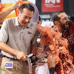
Go Cards!! ⚾️

Game one to the good guys. #GoCards https://t.co/9hHrbSlHEJ
ALERT | A Flash Flood Warning has been issued for the highlighted area until Jun 06 10:00PM EDT. Turn around, don't drown! Never drive through flooded roads. Watch WHAS11 News for the latest forecast. https://t.co/sAhFap2ygy
RT @sarandon_raboin: I actually spoke with @jvonnehadley as the team was walking into the gates Here's what he said about coming out to s…

