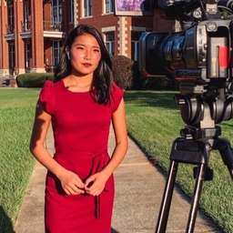
Sam Gabrielli
Meteorologist at WHAS-TV (Louisville, KY)
Meteorologist and Flight Dispatcher. Proud #cyclONEnation alum. Minnesota Made. Ohio River Valley living
Articles
-
Jan 16, 2025 |
whas11.com | Sam Gabrielli
LOUISVILLE, Ky. — The weekend spoiled us with snow melt and high temperatures in the 40s. Mother Nature is soon about to remind us that it still is the Winter Season. We will pick up frigid, cold air just in time for early next week. Prepare now for wind chill temperatures well into the subzero range and actual air temperatures in the single digits. The worst of the cold will be Monday morning through Tuesday morning.
-
Jan 11, 2025 |
whas11.com | Sam Gabrielli
LOUISVILLE, Ky. — Between both last Sunday-Monday's winter storm as well as this Friday's winter storm system, some locations across our area picked up a solid half foot to a foot of snow! If you are not a fan of winter, then you will be a happy camper Sunday and Monday as temperatures will be warm enough for snow to melt.
-
Nov 20, 2024 |
whas11.com | Sam Gabrielli
LOUISVILLE, Ky. — Danielle Dingess was shocked to find an all-black caterpillar at her home in the Okolona/Highview area while waiting for a delivery earlier this week. "Uh oh," she wrote in a post on WHAS11's Kentucky/Indiana Cloud Watchers Facebook group. "Solid black woolly worm...think [they] say solid black means a bad winter." Interestingly, these little creatures can be responsible for predicting what kind of winter you can expect in central Kentucky and southern Indiana.
-
Nov 20, 2024 |
whas11.com | Sam Gabrielli
LOUISVILLE, Ky. — Right on schedule for this time of year, Mother Nature is providing the Louisville Metro area with its first chance for snow flurries on Thursday. A fairly strong storm system is brewing just to our north and will provide wind, some snow flurries and freezing temperatures to central Kentucky and southern Indiana. Here's when we normally pick up our first light snow amounts of the fall and winter seasons.
-
Nov 12, 2024 |
whas11.com | Sam Gabrielli
LOUISVILLE, Ky. — Another band of showers and some thundershowers will arrive late in the day and into the evening hours Wednesday. Most spots west of I-65 will pick up the rain beginning around 4 p.m. or 5 p.m. Wednesday with spots along and east of I-65 will receive the rain beginning at sunset and beyond. Expect scattered to widespread rain all night Wednesday with some additional showers into the day Thursday. The rain will begin to taper off during the midday and afternoon hours Thursday.
Journalists covering the same region

Jamie Mayes
Reporter and Multimedia Journalist at WLKY-TV (Louisville, KY)
Jamie Mayes primarily covers news in Louisville, Kentucky, United States and surrounding areas.

Valerie Chinn
Anchor and Reporter at WDRB-TV (Louisville, KY)
Valerie Chinn primarily covers news in Louisville, Kentucky, United States and surrounding areas.

Khyati Patel
Anchor and News Reporter at Spectrum News 1 (Louisville, KY)
Anchor and News Reporter at Spectrum News 1 (Northern ,KY)
Khyati Patel primarily covers news in Louisville, Kentucky, United States and surrounding areas.

Sarah Magin
Digital Content Producer at WHAS-TV (Louisville, KY)
Sarah Magin primarily covers news in the Greater Louisville area including surrounding regions in Kentucky, United States.

Molly Jett
Molly Jett primarily covers news in Louisville, Kentucky, United States and surrounding areas.
Try JournoFinder For Free
Search and contact over 1M+ journalist profiles, browse 100M+ articles, and unlock powerful PR tools.
Start Your 7-Day Free Trial →Coverage map
X (formerly Twitter)
- Followers
- 1K
- Tweets
- 7K
- DMs Open
- No

RT @BenPeineWeather: TODAY'S FORECAST: A couple more rounds of showers and storms possible today. The next one around midday, then another…

Prayers for all affected by the #KentuckyTornado event 🙏🏼

RT @HenryWX: Somerset, KY moments ago. Wow. https://t.co/AwKfST1JQt
