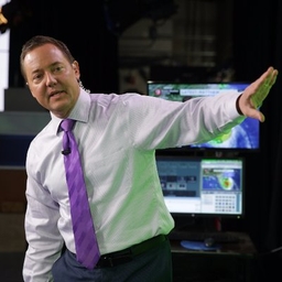
Tom Terry
Chief Meteorologist at WFTV-TV (Orlando, FL)
Chief Meteorologist at WRDQ-TV (Orlando, FL)
Chief Meteorologist at WFTV/WRDQ. Weather hound, busy dad and hubby. Helping folks #hunkerdown since 1989! Send me pics! Tweeting us? You may be on air
Articles
-
3 weeks ago |
wftv.com | Tom Terry
ORLANDO, Fla. — Central Florida will experience a drier pattern this weekend due to slightly lower moisture levels in the atmosphere, resulting in fewer afternoon downpours. As a result, the chances of rain will be around 10-20% on Saturday and 20-30% on Sunday. With the drier conditions, temperatures are expected to rise into the lower to mid-90s, leading to a heat index that will exceed 100 degrees.
-
3 weeks ago |
yahoo.com | Tom Terry |Beatriz Oliveira
Central Florida will experience a drier pattern this weekend due to slightly lower moisture levels in the atmosphere, resulting in fewer afternoon downpours. As a result, the chances of rain will be around 10-20% on Saturday and 20-30% on Sunday. With the drier conditions, temperatures are expected to rise into the lower to mid-90s, leading to a heat index that will exceed 100 degrees.
-
3 weeks ago |
wdbo.com | Tom Terry
ORLANDO, Fla. — A large area of dry, dusty air is currently overhead, bringing us hazy sunshine mixed with clouds this afternoon. This dry layer of air primarily exists between 5,000 and 10,000 feet above the ground but can occasionally reach the surface, affecting things like our cars when it rains. Essentially, this layer of dry air reduces our chances of rain, which will be evident as we head into the weekend.
-
3 weeks ago |
wftv.com | Tom Terry
ORLANDO, Fla. — A large area of dry, dusty air is currently overhead, bringing us hazy sunshine mixed with clouds this afternoon. This dry layer of air primarily exists between 5,000 and 10,000 feet above the ground but can occasionally reach the surface, affecting things like our cars when it rains. Essentially, this layer of dry air reduces our chances of rain, which will be evident as we head into the weekend.
-
3 weeks ago |
yahoo.com | Tom Terry |Beatriz Oliveira
A large area of dry, dusty air is currently overhead, bringing us hazy sunshine mixed with clouds this afternoon. This dry layer of air primarily exists between 5,000 and 10,000 feet above the ground but can occasionally reach the surface, affecting things like our cars when it rains. Essentially, this layer of dry air reduces our chances of rain, which will be evident as we head into the weekend.
Journalists covering the same region
Madison Skowronski
Writer at WDW News Today
Madison Skowronski primarily covers news in Orlando, Florida, United States and surrounding areas.
Emely Albelo
Lifestyle Journalist at Osceola News Gazette
Emely Albelo primarily covers news in Orlando, Florida, United States and surrounding areas.

Steven Walker
Education Reporter at Orlando Sentinel
Steven Walker primarily covers news in Orlando, Florida, United States and surrounding areas including Kissimmee and Winter Park.

Nicole Darden-Creston
Host, Anchor and Reporter at Central Florida Public Media
Nicole Darden-Creston primarily covers news in Orlando, Florida, United States and surrounding areas including Kissimmee and Winter Park.
Jean Gonzalez
Online Director at Florida Catholic
Jean Gonzalez primarily covers news in Orlando, Florida, United States and surrounding areas including Kissimmee and Winter Park.
Try JournoFinder For Free
Search and contact over 1M+ journalist profiles, browse 100M+ articles, and unlock powerful PR tools.
Start Your 7-Day Free Trial →Coverage map
X (formerly Twitter)
- Followers
- 19K
- Tweets
- 28K
- DMs Open
- No

Incredible rain rates over 7"/hr (some mixed with hail), so localized flooding expected west Orange county. Severe storms near Camping World Stadium, Orange county https://t.co/g2iVYpqJ9C

Severe thunderstorm warning for west Orange county until 7:15pm. @WFTV Severe storms near Camping World Stadium, Orange county https://t.co/Pt5NwBcct4

RT @WFTV: Be Prepared: How to stay safe and get ready for 2025 hurricane season https://t.co/ursGehRc5S